Volcano earthquake report for Friday, 5 Nov 2021
Fri, 5 Nov 2021, 23:50 | BY: EARTHQUAKEMONITOR
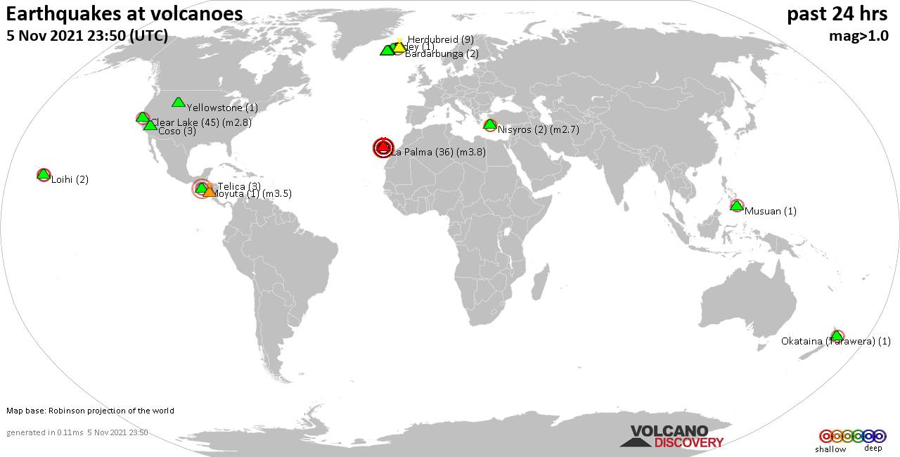
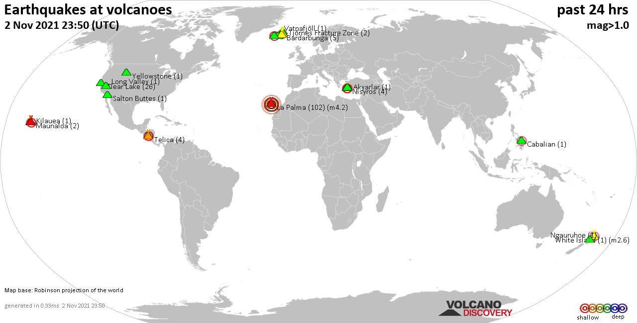
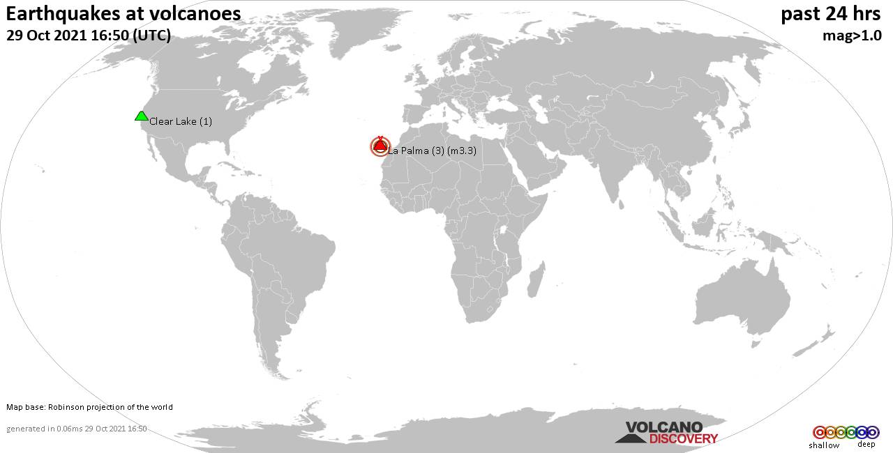
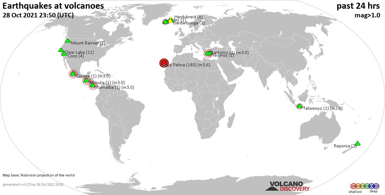
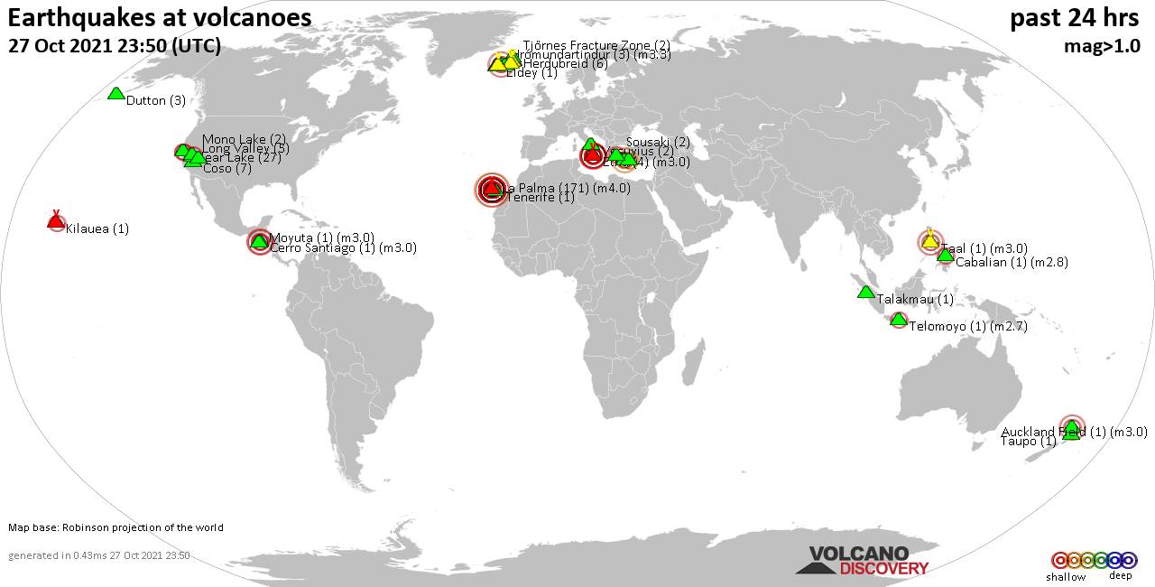
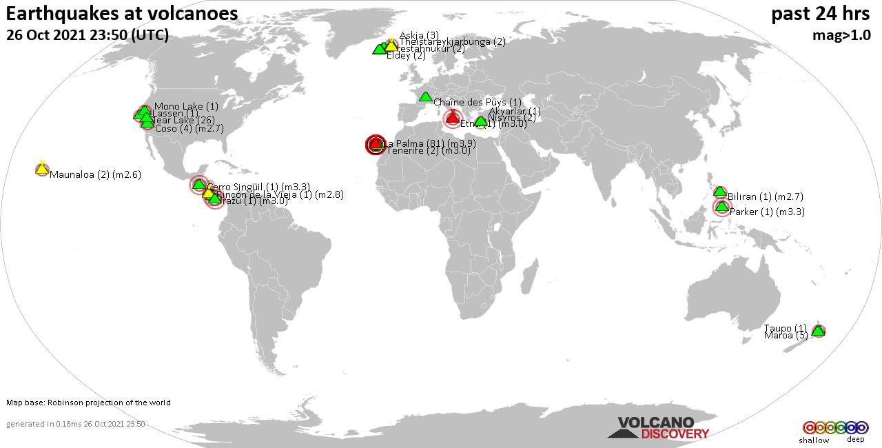
World map showing volcanoes with shallow (less than 20 km) earthquakes within 20 km radius during the past 24 hours on 5 Nov 2021 Number in brackets indicate nr of quakes.
Herdubreid (9 quakes between mag 0.2-1.0), Krísuvík (26 quakes between mag 0.1-1.1), La Palma (36 quakes between mag 2.3-3.8), Langjökull (4 quakes between mag 1.0-1.2), Loihi (2 quakes between mag 2.4-2.4), Moyuta (1 quake mag 3.5), Musuan (1 quake mag 2.4), Nisyros (2 quakes between mag 2.1-2.7), Okataina (Tarawera) (1 quake mag 2.3), Reykjanes (12 quakes between mag 0.1-1.8), Telica (3 quakes between mag 1.3-1.5), Yellowstone (1 quake mag 1.2) (updated 23h50)
Note: Earthquakes within 20 km from and at depths less than 20 km under active volcanoes are reported. The list is not complete because many volcanoes are not monitored and/or seismic data in high resolution is not available publicly.
Volcanoes with recent earthquakes above magnitude 2 or more than 10 quakes are listed below:
Bardarbunga volcano (Iceland): 2 earthquakes up to magnitude 2.1
2 earthquakes occurred near (under) the volcano during 3 hours, the last being recorded quake 18 hours ago. Hypocenter depths ranged between 18.5 and 3.7 km.Earthquake details:
2.1 quake Iceland: 3.1 Km N of Bárðarbunga Nov 5, 2021 5:20 am (GMT +0) (4 km N)
1.1 quake Iceland: 17.8 Km ESE of Bárðarbunga Nov 5, 2021 2:04 am (GMT +0) (18 km ESE)
All earthquakes at Bardarbunga
Clear Lake volcano (California): 45 earthquakes up to magnitude 2.8
Possible earthquake swarm: 45 earthquakes occurred near (under) the volcano during 20 hours, the last being recorded quake 2 hours ago. Hypocenter depths ranged between 4.7 and 0.5 km.Earthquake details: (only 5 largest)
2.8 quake 13 mi southwest of Clearlake, Lake County, California, USA, Nov 4, 2021 11:59 pm (GMT -7) (16 km SSW)
1.4 quake 8km NW of The Geysers, CA, Nov 5, 2021 12:16 am (GMT -7) (16 km SSW)
1.4 quake 4km W of Cobb, CA, Nov 5, 2021 10:19 am (GMT -7) (17 km S)
1.4 quake 8km W of Cobb, CA, Nov 5, 2021 12:07 am (GMT -7) (16 km SSW)
1.2 quake 9km WNW of Cobb, CA, Nov 4, 2021 7:33 pm (GMT -7) (14 km SSW)
All earthquakes at Clear Lake
Krísuvík volcano (Reykjanes Peninsula, Iceland): 26 earthquakes up to magnitude 1.1
Possible earthquake swarm: 26 earthquakes occurred near (under) the volcano during 17 hours, the last being recorded quake 6 hours ago. Hypocenter depths ranged between 7.2 and 2.2 km.Earthquake details: (only 5 largest)
1.1 quake Iceland: 2.4 Km SSW of Keilir Nov 5, 2021 12:43 pm (GMT +0) (5 km WSW)
0.9 quake Iceland: 2.7 Km SSW of Keilir Nov 5, 2021 1:13 pm (GMT +0) (5 km WSW)
0.8 quake Iceland: 2.1 Km SSW of Keilir Nov 5, 2021 12:15 pm (GMT +0) (4 km W)
0.6 quake Iceland: 2.7 Km SSW of Keilir Nov 5, 2021 1:43 pm (GMT +0) (5 km WSW)
0.6 quake Iceland: 1.5 Km SSW of Keilir Nov 5, 2021 3:23 am (GMT +0) (4 km W)
All earthquakes at Krísuvík
La Palma volcano (Canary Islands): 36 earthquakes up to magnitude 3.8
Possible earthquake swarm: 36 earthquakes occurred near (under) the volcano during 22 hours, the last being recorded quake 1 hour 59 minutes ago. Hypocenter depths ranged between 15.0 and 10.0 km.Earthquake details: (only 5 largest)
3.8 quake La Palma Island, 14 km southeast of Los Llanos de Aridane, Spain, Nov 5, 2021 2:53 am (GMT +0) (3 km SSE)
3.5 quake La Palma Island, 12 km southeast of Los Llanos de Aridane, Spain, Nov 5, 2021 4:21 am (GMT +0) (2 km S)
3.4 quake La Palma Island, 13 km southeast of Los Llanos de Aridane, Spain, Nov 5, 2021 1:36 am (GMT +0) (2 km SSE)
3.4 quake La Palma Island, 12 km south of Los Llanos de Aridane, Spain, Nov 5, 2021 11:39 am (GMT +0) (5 km SSE)
3.4 quake La Palma Island, 14 km southeast of Los Llanos de Aridane, Spain, Nov 5, 2021 6:29 am (GMT +0) (5 km S)
All earthquakes at La Palma
Loihi volcano (Hawai'i (Big Island)): 2 earthquakes up to magnitude 2.4
2 earthquakes occurred near (under) the volcano during 3 hours, the last being recorded quake 18 hours ago. Hypocenter depths ranged between 11.4 and 9.5 km.Earthquake details:
2.4 quake 33 Km SE of Pāhala, Hawaii, Nov 4, 2021 8:19 pm (GMT -10) (5 km N)
2.4 quake 46 Km ESE of Naalehu, Hawaii, Nov 4, 2021 5:19 pm (GMT -10) (10 km SE)
All earthquakes at Loihi
Moyuta volcano (Guatemala): magnitude 3.5 earthquake
A magnitude 3.5 earthquake occurred at the volcano 7 hours ago. The quake, which might be volcanic in origin, was located at a depth of 1.0 km depth at 8 km distance NW from the volcano.Earthquake details:
3.5 quake Departamento de Santa Rosa, 35 km southwest of Jutiapa, Guatemala, Nov 5, 2021 10:59 am (GMT -6) (8 km NW)
All earthquakes at Moyuta
Musuan volcano (Mindanao): magnitude 2.4 earthquake
A magnitude 2.4 earthquake occurred at the volcano 23 hours ago. The quake, which might be volcanic in origin, was located at a depth of 10.0 km depth at 10 km distance NNE from the volcano.Earthquake details:
2.4 quake Mindanao, 12 km south of Malaybalay, Philippines, Nov 5, 2021 9:08 am (GMT +8) (10 km NNE)
All earthquakes at Musuan
Nisyros volcano (Greece): 2 earthquakes up to magnitude 2.7
2 earthquakes occurred near (under) the volcano during 14 hours, the last being recorded quake 1 hour 54 minutes ago. Hypocenter depths ranged between 16.6 and 14.2 km.Earthquake details:
2.7 quake Aegean Sea, 48 km south of Kos, Dodecanese, South Aegean, Greece, Nov 5, 2021 9:41 am (GMT +2) (8 km SW)
2.1 quake Aegean Sea, 51 km south of Kos, Dodecanese, South Aegean, Greece, Nov 5, 2021 11:56 pm (GMT +2) (15 km SSW)
All earthquakes at Nisyros
Okataina (Tarawera) volcano (New Zealand): magnitude 2.3 earthquake
A magnitude 2.3 earthquake occurred at the volcano 4 hours ago. The quake, which might be volcanic in origin, was located at a depth of 6.4 km depth at 14 km distance E from the volcano.Earthquake details:
2.3 quake North Island, 3.3 km west of Kawerau, Bay of Plenty, New Zealand, Nov 6, 2021 8:55 am (GMT +13) (14 km E)
All earthquakes at Okataina (Tarawera)
Reykjanes volcano (Reykjanes Peninsula, Iceland): 12 earthquakes up to magnitude 1.8
Possible earthquake swarm: 12 earthquakes occurred near (under) the volcano during 22 hours, the last being recorded quake 1 hour 41 minutes ago. Hypocenter depths ranged between 8.9 and 4.0 km.Earthquake details: (only 5 largest)
1.8 quake Iceland: 1.7 Km NNW of Reykjanestá Nov 5, 2021 10:18 am (GMT +0) (13 km SW)
1.6 quake Iceland: 7.5 Km NNE of Reykjanestá Nov 5, 2021 9:31 am (GMT +0) (6 km SW)
0.9 quake Iceland: 5.8 Km NNE of Reykjanestá Nov 5, 2021 8:08 pm (GMT +0) (8 km SW)
0.9 quake Iceland: 7.7 Km NNE of Reykjanestá Nov 5, 2021 10:01 am (GMT +0) (6 km SW)
0.9 quake Iceland: 1.7 Km NNW of Reykjanestá Nov 5, 2021 10:18 am (GMT +0) (13 km SW)
All earthquakes at Reykjanes
Previous news
Thu, 4 Nov 2021, 23:50
Volcano earthquake report for Thursday, 4 Nov 2021

Quakes detected near: Akutan (1 quake mag 1.9), Bardarbunga (5 quakes between mag 0.4-1.4), Chaîne des Puys (1 quake mag 1.0), Clear Lake (7 quakes between mag 0.4-2.0), Denison (2 quakes between mag 1.1-1.3), Esjufjöll (1 quake mag 1.3) ... Read all
Wed, 3 Nov 2021, 23:50
Volcano earthquake report for Wednesday, 3 Nov 2021
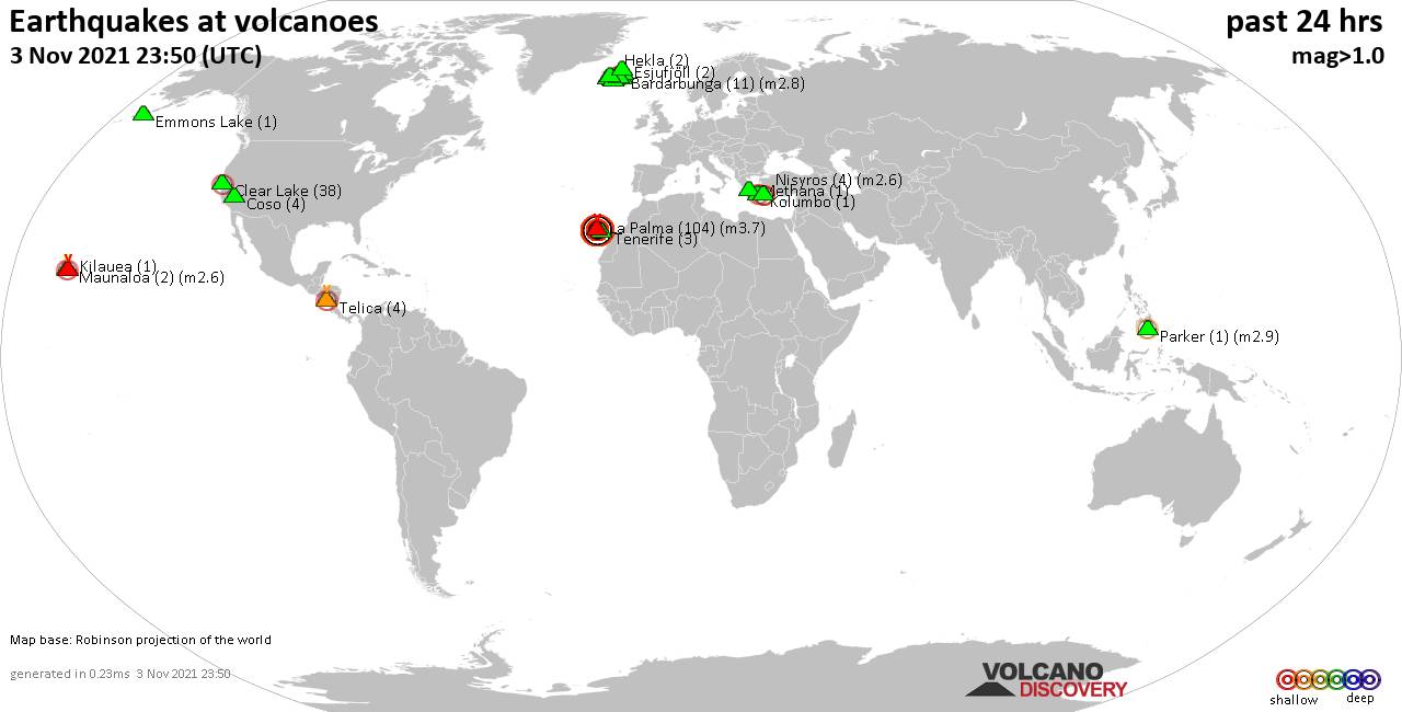
Quakes detected near: Bardarbunga (11 quakes between mag 0.1-2.8), Clear Lake (38 quakes between mag 0.3-2.1), Coso (4 quakes between mag 0.5-1.3), Emmons Lake (1 quake mag 1.7), Esjufjöll (2 quakes between mag 0.9-1.2), Hekla (2 quakes between mag 0.8-1.1) ... Read all
Show more